3D Map

Smarter Site Data with Drone Surveying and Mapping

Drone Surveying in Melbourne with Melbourne Manufacturing

Accurate site information is the foundation of every successful project, whether you’re planning a new workshop layout, expanding an existing facility, or documenting a complex industrial site. As technology evolves, more businesses are turning to drone surveying and mapping in Melbourne as a faster, safer, and more cost-effective way to capture precise spatial data.

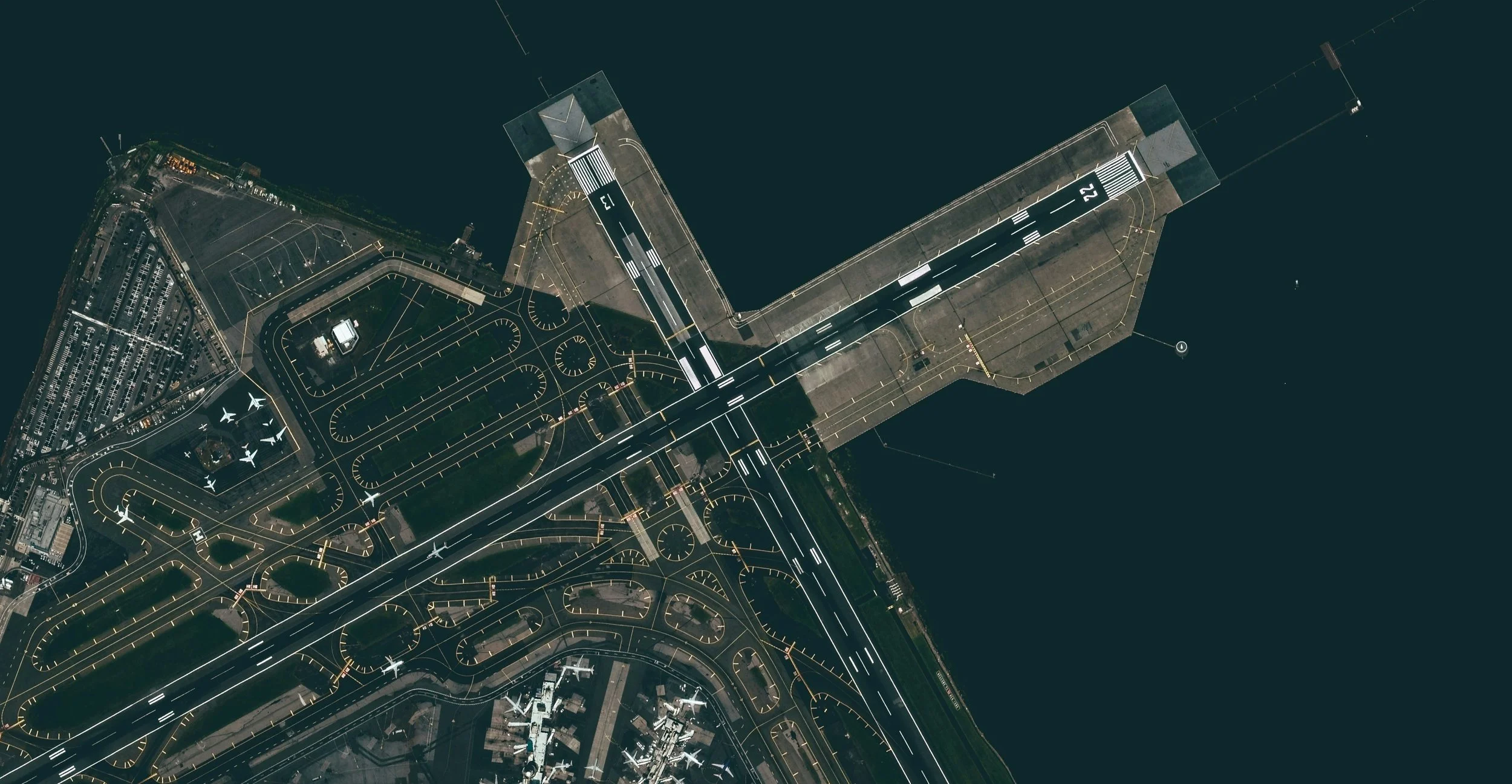
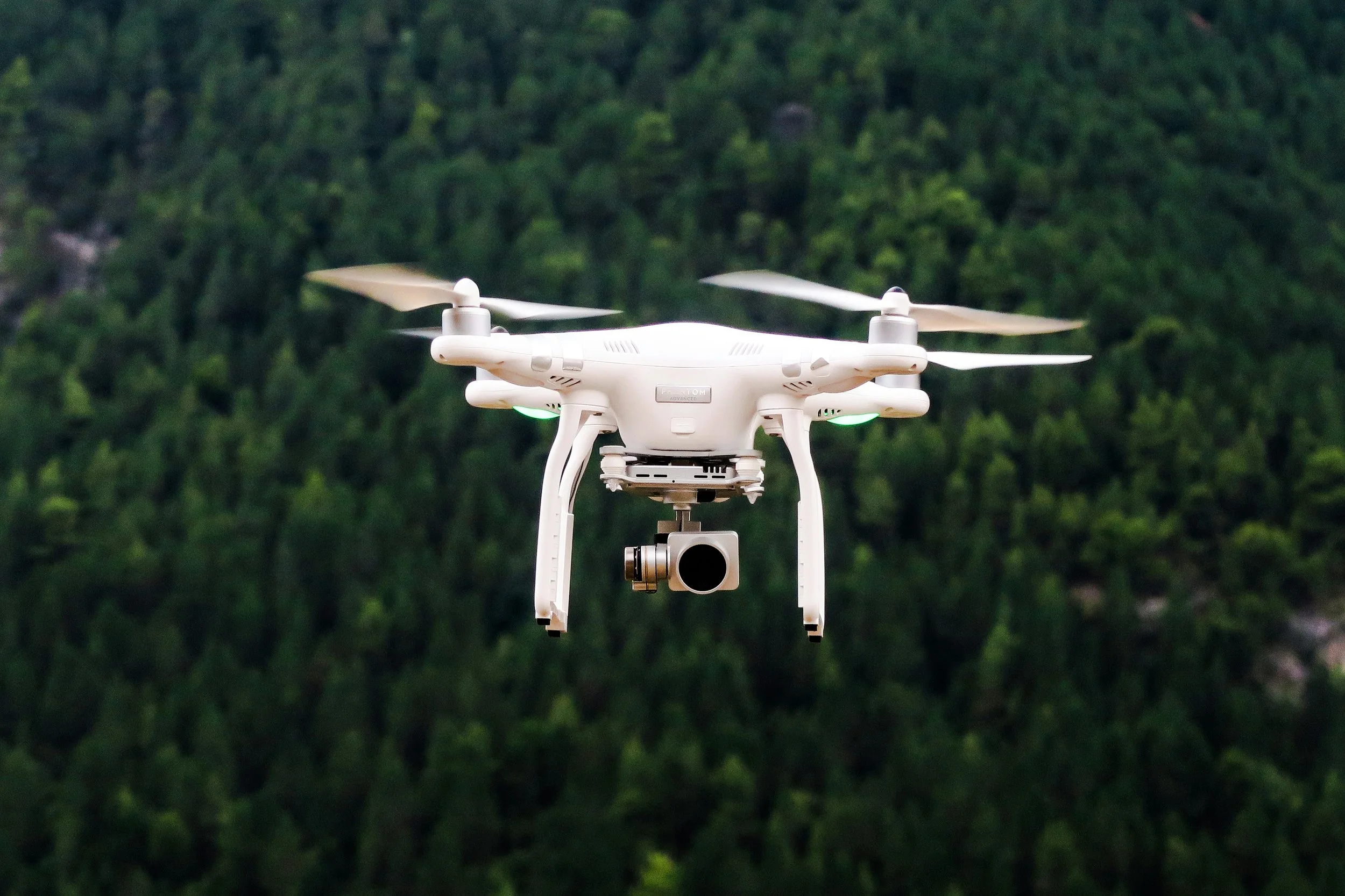
Drone-based surveying uses high-resolution aerial imagery and photogrammetry to generate detailed maps, measurements, and 3D models of sites. Compared to traditional surveying methods, drones can capture large or difficult-to-access areas quickly, minimising downtime and reducing safety risks for workers on site.

Why Businesses Are Choosing Drone Surveying

One of the biggest advantages of drone surveying and mapping in Melbourne is efficiency. Flights can often be completed in a fraction of the time required for manual surveys, allowing projects to move forward sooner. This is particularly valuable for manufacturing sites, warehouses, construction zones, and industrial facilities where time delays can be costly.

Drone data also provides a high level of accuracy. Modern drones capture hundreds or thousands of overlapping images, which are processed into orthomosaics and 3D models that allow for precise measurements. This accuracy supports better decision-making during planning, design, and construction phases.

Applications Across Manufacturing and Industry

Drone surveying and mapping in Melbourne is increasingly being used for factory layouts, warehouse planning, site documentation, roof inspections, and progress tracking. For manufacturers and fabricators, aerial mapping provides a clear overview of available space, access points, equipment placement, and workflow constraints.

This type of data is especially powerful when planning upgrades or reconfigurations, as it allows stakeholders to visualise the site from above and identify inefficiencies that may not be obvious from ground level.

Improved Accuracy for Design and CAD Integration

Another major benefit of drone surveying and mapping in Melbourne is how seamlessly it integrates with CAD workflows. Aerial data can be used to generate accurate base drawings that inform shop layout designs, equipment placement, and future expansion planning.

By starting with reliable site data, designers and engineers can reduce assumptions, minimise rework, and improve overall project outcomes. This leads to better coordination between planning, design, and fabrication teams.

A Cost-Effective and Scalable Solution

Compared to traditional methods, drone surveying and mapping in Melbourne can offer significant cost savings, particularly for large or complex sites. The ability to quickly capture accurate data makes it easier to revisit sites, update plans, or document changes over time without major disruption.

This scalability makes drone surveying an ideal solution for both small businesses and larger industrial operations.

Work With a Melbourne-Based Team You Can Trust

As a small, remote Melbourne-based business, we combine precision CAD expertise with modern aerial mapping technology to deliver practical, real-world solutions. Our drone surveying and mapping in Melbourne services are designed to support smarter planning, safer sites, and more efficient project delivery.

If you’re considering drone mapping for your site or upcoming project, we’d love to help. Get in touch today to book an obligation-free quote and find out how accurate aerial data can support your next stage of growth.

contact@melbournemfg.com

The Benefits of Aerial Photogrammetry in Melbourne

drone mapping in melbourne for cad drawings melbourne manufacturing

In today’s fast-paced construction, manufacturing, and surveying industries, precision and efficiency are more important than ever. One technology that has transformed the way businesses capture and analyze site data is aerial photogrammetry. For companies in Victoria, particularly those seeking aerial photogrammetry in Melbourne, this technology offers unparalleled accuracy and convenience.

Aerial photogrammetry involves using drones or aircraft to capture high-resolution images of a site, which are then processed to create detailed 2D maps, 3D models, and accurate measurements. Unlike traditional surveying methods, aerial photogrammetry allows for rapid data collection over large areas, reducing the time, cost, and manpower required. Businesses can get a complete overview of their site in a fraction of the time it would take using conventional methods.

One of the main advantages of aerial photogrammetry in Melbourne is its ability to provide precise, high-resolution data. For construction and manufacturing projects, accurate measurements are critical to ensure designs are implemented correctly. With aerial photogrammetry, teams can identify potential issues early, monitor progress, and make informed decisions based on reliable data. This reduces costly mistakes and improves project efficiency.

Safety is another key benefit. Traditional surveying methods often require personnel to access hard-to-reach or potentially hazardous areas. Aerial photogrammetry allows drones to capture detailed images from above, keeping teams safely on the ground while still obtaining all the necessary data. For industries like construction, mining, and civil engineering, this technology significantly reduces the risk of accidents.

Additionally, aerial photogrammetry in Melbourne supports better project planning and management. By providing a bird’s-eye view of a site, it’s easier to visualize workflows, plan material placement, and coordinate teams. Project managers can track progress over time, compare designs with actual site conditions, and generate accurate reports to share with stakeholders. This level of insight streamlines communication and ensures everyone involved is on the same page.

Environmental and land surveys also benefit from aerial photogrammetry. Mapping large areas for urban planning, forestry, or environmental monitoring can be completed quickly and accurately. High-resolution 3D models help professionals analyze terrain, monitor changes over time, and make data-driven decisions. This is why more businesses and government agencies are turning to aerial photogrammetry in Melbourne for reliable and cost-effective surveying solutions.

The versatility of aerial photogrammetry is another reason for its growing popularity. Whether you need detailed topographic maps, volumetric measurements for stockpiles, or 3D models for site planning, this technology delivers high-quality results. Companies can combine CAD drafting and drone mapping services to get a comprehensive view of their project from design to completion.

If you’re looking to harness the power of aerial photogrammetry in Melbourne, now is the perfect time to explore the benefits for your business. From increased accuracy and efficiency to improved safety and project management, aerial photogrammetry is revolutionizing the way projects are planned and executed.

Contact us today for an obligation-free quote and discover how our aerial photogrammetry services can help streamline your projects. Whether it’s for construction, manufacturing, or land surveying, we provide precise, reliable, and actionable data tailored to your needs. Don’t wait – experience the advantages of aerial photogrammetry in Melbourne and take your projects to the next level.

contact@melbournemfg.com

Unlocking the Potential of Drone Mapping in Melbourne

Drone Mapping and Survey with Melbourne Manufacturing

In recent years, drone technology has revolutionized the way we approach surveying, construction, and site management. One of the most powerful applications of this technology is drone mapping in Melbourne, offering an efficient, accurate, and cost-effective solution for businesses and property owners alike. By leveraging drones equipped with high-resolution cameras and photogrammetry software, we can capture detailed aerial imagery and transform it into precise 2D maps and 3D models of any site.

One of the primary benefits of drone mapping in Melbourne is its ability to provide highly accurate measurements without the need for traditional, labor-intensive surveying methods. Instead of sending multiple surveyors on-site, a drone can fly a pre-planned route, capturing hundreds of overlapping images in a fraction of the time. These images are then processed to create orthomosaic maps, point clouds, and 3D models that allow users to measure distances, areas, and volumes with pinpoint precision. This level of accuracy is especially valuable for construction projects, real estate developments, and infrastructure planning, where even small errors can lead to costly delays.

Another significant advantage of drone mapping in Melbourne is safety. Working at heights or on difficult terrain can be risky for surveyors and construction teams. Drones eliminate the need for people to access hazardous areas, reducing the risk of accidents while still providing comprehensive site data. For building inspections, roof assessments, or complex industrial sites, drone mapping offers a safe, non-invasive way to gather information that would otherwise be time-consuming and potentially dangerous to obtain.

Time efficiency is also a standout benefit. Traditional land surveys can take days or even weeks, depending on the site size and complexity. With drone mapping in Melbourne, large areas can be surveyed in just a few hours. Rapid data collection and processing mean that project managers, architects, and engineers can access actionable insights sooner, enabling quicker decision-making and keeping projects on schedule. This fast turnaround is particularly beneficial in dynamic industries where time is money.

Cost savings are another reason more Melbourne businesses are adopting drone mapping. By reducing the need for extensive manpower, specialized equipment, and multiple site visits, drones can significantly lower overall project costs. The combination of reduced labor, faster data collection, and improved accuracy translates into a more streamlined workflow and better resource management.

Our team specializes in providing professional drone mapping in Melbourne, offering tailored services to meet the needs of construction companies, property developers, surveyors, and more. We can map residential, commercial, or industrial sites with precision, delivering comprehensive reports, 3D models, and georeferenced maps that integrate seamlessly into your existing workflows. Whether you need a detailed topographical survey, a volumetric analysis, or regular site monitoring, our drone mapping services ensure you have the data you need to make informed decisions.

Choosing professional drone mapping in Melbourne gives you access to cutting-edge technology, enhanced safety, faster project timelines, and cost-effective solutions. Drones are not just a novelty—they are an essential tool for modern surveying and site management, empowering businesses to achieve more with less effort.

Contact us today for an obligation-free quote and see how our drone mapping services can transform your next project.

contact@melbournemfg.com